|
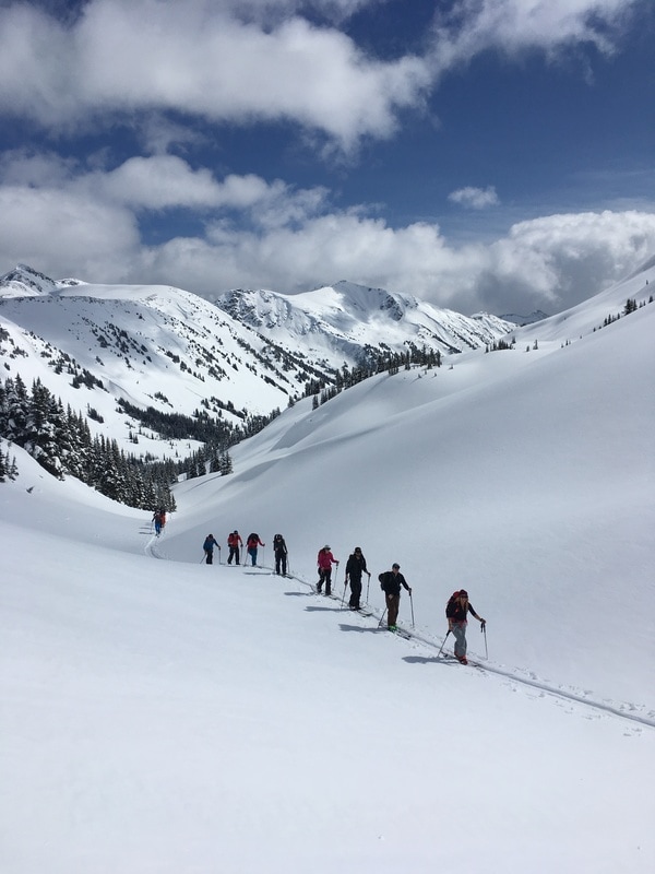
Maz and I stared across the aqua blue lake which was shimmering in the sunlight beneath towering white peaks and clear blue skies. We were lost in conversation. The crisp winter air was refreshing as we walked along the main road out of town, hardly noticing that we had been trying for almost an hour to hitch a ride to the bottom of Roy’s Peak, in Wanaka New Zealand. We were talking about our respective adventures from the recently finished ski season in the Northern Hemisphere. Maz, I discovered, was also an avid skier, backcountry enthusiast, and fellow adventure junkie. I explained to her that I wanted to spend a season kayak guiding after finishing the ski season in New Zealand. Maz told me about a ski mountaineering course she had just finished in Canada, “The guide was really cool, she just came back from a ski mountaineering trip in Kyrgyzstan. I’d like to do an all girls backcountry ski trip to Kyrgyzstan.” Without a second’s hesitation I said: “I’m in.” Thoughts of what it might be like to ski in Kyrgyzstan filled my mind. What was the skiing like there? The idea of a ski adventure to that corner of the world felt both exciting and exhilarating, but at the same time, distant. Something that was fun to talk about but happen years down the road. Though Maz and I had only met three days before, a friendship quickly formed. We discussed the micro-adventures we would like to do over the course of the winter in New Zealand, the powder filled ski days that hopefully lay ahead, and the people we could share these adventures with. Little did I know that hike up Roy’s Peak on a sunny Wednesday morning would change my trajectory and focus for the next year and a half. 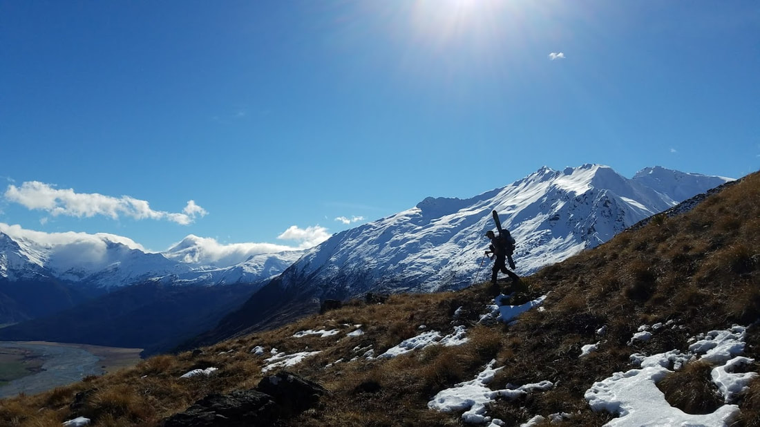 I grew up on the west coast of Canada and as far back as I can remember, I have enjoyed adventure filled days with friends. As a child adventure looked a little different and closer to home than it does now; exploring the forested areas behind my house, scrambling up rocks, telling anybody who would listen that I was going to climb Mt Everest one day, long summer evenings around the campfire with my family, and sunny days spent swimming in the lake. At the age of 10, I fell in love with skiing and dreamed of being an adventure photographer and ski instructor. I am a perfectionist by nature, when I do something I like to do it well. Those who know me will agree that I like to approach situations well informed and prepared. This has been a hindrance and a help as I have traveled and explored near and far. We slowly started ticking things off of our adventure bucket list; we made the most of days off, by biking, kayaking, skiing, ski touring, and climbing with an awesome crew of like-minded friends. All the while we discussed plans for Kyrgyzstan in an abstract, distant manner. One memorable evening in August a group of us met up to dig a snow cave. After a sweaty few hours we had a small snow palace to call home for the night and enjoyed the sunset over mulled wine, cheese, and homemade curry. These small impromptu micro-adventures, as we called them, fuelled my sense of exploration and reminded me why I love the outdoors. They taught me that the best adventures are the ones that are unplanned, where the outcome is unknown. I didn't always have to have a plan to have fun. 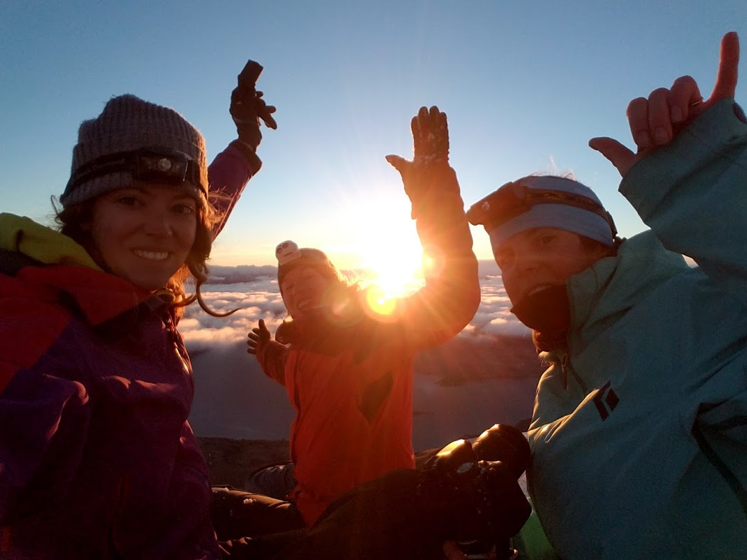 Shortly after the night in the snow cave, Maz and I had a discussion about when we could do the trip to Kyrgyzstan. We realized that we were both in a place in our lives with no major commitments and the time to plan and train for an expedition. Why not do the trip as soon as possible? Who knew what the next year would bring and if we would have this opportunity again? We decided we were going to pursue a self-guided, all female ski adventure across a remote and infrequently travelled mountain range in Kyrgyzstan, researching the effects of climate change in this remote region. A date was set for January 2017, 6 months away. The thought of doing this kind of trip in such a short time frame put me well outside my comfort zone, what if we weren’t ready in time? There were so many factors to consider. We had a team of 5 girls and “Seeking Balance, Finding Adventure” was born. We applied for grants, we researched possible sponsorship, we contacted everybody and anybody we knew who had visited Kyrgyzstan before. With a background in outdoor education and guiding, I knew that a ski trip to Kyrgyzstan would take both time and careful planning. Connections would need to be made, itineraries written, budgets created, gear lists put together, meal plans prepared, routes scouted, and a lot of personal training to be done. 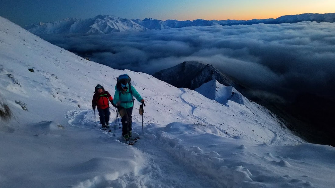 The next three months passed by quickly; Maz moved back to Aspen where she continued to work as a physiotherapist and ski instructor. I moved back to Hong Kong and continued to lead expeditions and deliver outdoor education programs. The 5 girls were spread across 3 different continents, which meant a lot of early morning and late night phone calls, cross continent messaging, and the use of online servers so we could all access the necessary documents. We were all busy; finding time to do expedition planning was challenging to say the least. We started a 5 week training program which meant waking up at 5 or 6 am each morning to squeeze in workouts while at the same time leading overnight trips. Six weeks before our departure date I hit rock bottom. Everything about the trip became overwhelming. We were runners up for a large grant, preparing for this grant had taken up a lot of our free time in the previous two weeks. This was one of many grants we had applied for but been unsuccessful. It felt as though no matter how hard we tried we were not moving forward. The costs of the expedition were quickly adding up. A day later we received an email advising us that one team member could no longer join us due to work commitments. Our 5 person team was to become 4. I was physically and mentally exhausted. I wondered if we should still be doing the trip. A few days later a good friend asked if I would like to hike the Lantau Trail in Hong Kong in one go; 70 kms and over 3500m of elevation gain.This was exactly what I needed to gain some perspective. 17 hours of good conversation, excellent company, and many gummy bears later, I felt like a new human; re-energized and motivated. I was reminded on that hike that things do not always have to be perfect or go to plan, all I could do was keep moving forward and try my best. We continued to plan and train with a new-found motivation but three weeks before the trip, we were faced with a difficult decision. Due to a combination of unfortunate events we decided to postpone our expedition. A difficult phone call between myself and Maz was had and we reset the date for January 2018. We had done all we could. Maz and I met in Vancouver, we identified areas that had gone well in the past few months and areas that had not gone so well. Plans were made for improvement and a group of 3 committed girls were ready to take on the challenge a second time. We focused on the task ahead rather than dwelling on the fact that our first attempt at the expedition to Kyrgyzstan had not gone as we had planned. 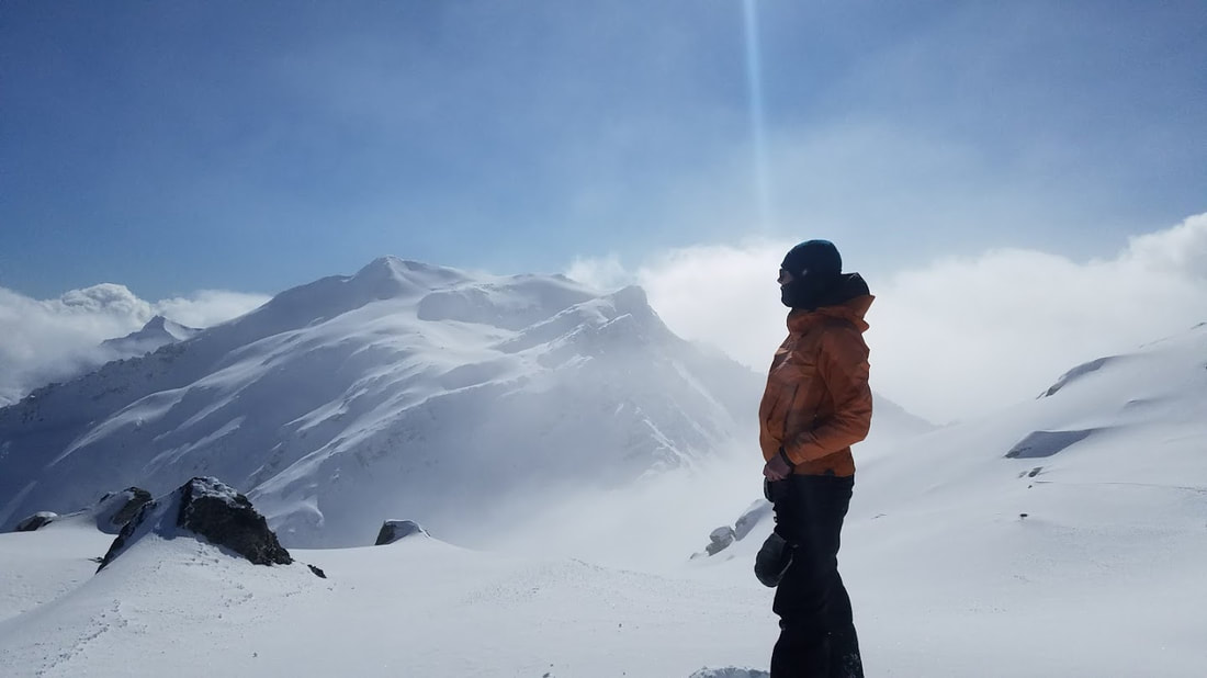 It has been a year exactly since that hike up Lantau Peak; I sit reflecting on all that has happened in the last 12 months. I think what a blessing in disguise it was that we did not go to Kyrgyzstan in January 2017. In the last year Maz, myself, and our teammate Nicole have been focused on our goal, traveled and trained hard to get to where we are now. We have collectively backcountry skied in 8 countries, focusing on technical ascents and always seeking to expand our knowledge base. We have ski toured up volcanoes in the Pacific Northwest, in remote areas of South America, and central New Zealand. We have journeyed up iconic glaciers in Norway and experienced the ski culture that exists in the far regions of the Kashmiri Himalayas. Maz was even invited to compete in the first ever Freeride World Tour Event in Asia, hosted in Hakuba Japan. We have had all the time in the world to train during the down season and have had to fight to make it out together during peak season. We have been so stretched and busy at points that Maz and I would go a week without seeing one another, despite living in the same house. There have been many highs punctuated with many lows; through it all, we have stayed focused on our goal and the three of us have supported one another during the process. One year later, we have all grown and made significant progress. Though we have not yet left for our trip I feel like I have gained so much in the process. Planning can only take you so far; planning helps you be prepared to navigate known or predictable events - and all the “What ifs?” Adventure lies in navigating the unknown and unexpected. We are excited to see what the unknown will hand us next as we enter the final stages of Kyrgyzstan 2018.
1 Comment
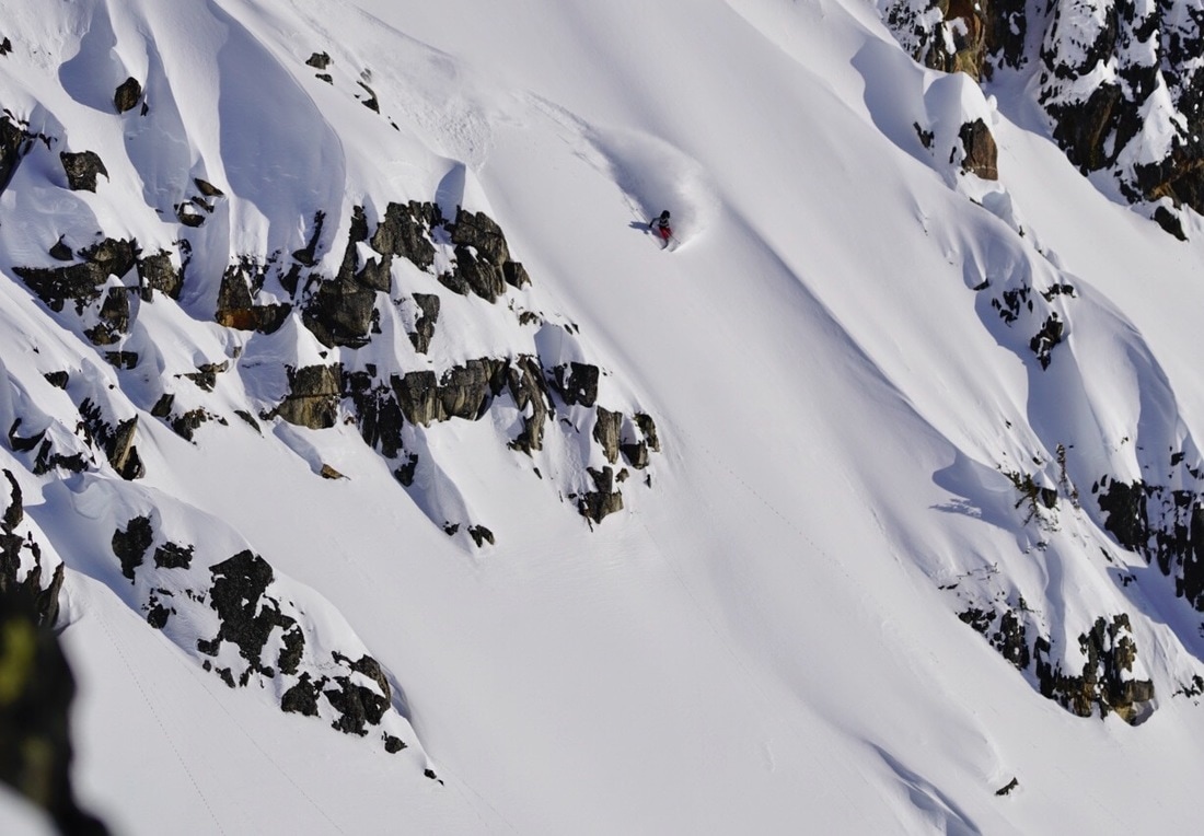
Firstly some background; I travelled to the North of Bolivia in November to visit the amazon (the Madidi National Park is the Bolivian amazon) instead though I ended up going to Serere Reserve (a sanctuary not actually in the national park/ Amazon but close) as a result of what I started to learn about the area. During my time in Serere I was able to interview one of the guides about his experience with conservation, the government and the local people. History of the Madidi National Park (Bolivian Amazon): After years of petitioning the government of Bolivia the Eco Bolivia Foundation (founded by a lady called Rosa Maria), along with the support of the World Bank, succeeded in creating the Madidi National park in 1995. This protected this diverse area, home to 11% of the world's bird population, from lumbering companies, hydroelectric schemes and various mining and roading projects. After this the Eco Bolivia Foundation started educating locals in the park so that they could undertake tourism initiatives. The foundation also built various structures to accommodate people. However the work was not over and in the ensuing years the government challenged the status of the park with attempts at various profit making activities which the Eco Bolivia Foundation stood up against and which eventually led to a violent attack on the Foundation and burning of their buildings within the park in 2003. After this the Eco Bolivia Foundation relocated and began work in restoring an area further East along the Beni river (which also runs through Madidi National Park). After removing 20 Tonnes of rubbish from an 81 square kilometre area of forest the Serere Sanctuary was borne in 2007. The following is my interview with our guide from the Serere Sanctuary: Q: Where did you grow up? A: In a jungle community in the North of Bolivia Q: And why did you leave? A: We have a ceremony that boys partake in at age 15 to become a man, they need to drink a herbal mix and undergo the experience that follows. My father wanted me to prove myself so he forced me to take it when I was 8 years old and I nearly died. My grandfather told my mother that my father was dangerous and that she should leave so she moved to a village slightly South East and I started working on the river banks helping with farming. I saw my first white person when I was 13. I never thought I would see a white person. Q: How did you start working for Serere reserve as a guide? A: I starting working as a guide in Madidi park when I was 18 because I had grown up in the jungle and had a lot of knowledge already and I had been learning English. I started hearing about what the Eco Bolivia Foundation/ Rosa Maria was doing to protect wildlife and offering working opportunities to locals and I approached her to start working at the Serere Sanctuary. Q: What is the situation with animals in the wild around Madidi/ Serere? A: There is still a culture around hunting animals in local tribes. Animals such as Monkeys, Caimans, Tapirs and Jaguars are still hunted and sold as meat. Q: Do you think local people are changing to care about conservation? A: It’s hard to say because where there is tourism surrounding the wildlife like in Rurranabaque town (access town to the Madidi National park/ Amazon) then yes people care but in the jungle communities who knows, they are poor and they don’t understand the importance of these animals and the nature. Q: What is happening to the conservation in Madidi national park? A: Evo Morales, the president of Bolivia, tells the world we have this park and it’s great and we are protecting the wildlife but then he goes and changes policies so that it is possible to build a hydroelectric dam along the Beni river and a highway through the park and he accommodates Chinese investors interests in mining gold and petroleum in the park. For instance there is already many mining activities and petroleum contracts operating within the park that are kept quite by the government and that even many locals wouldn't know about. Q: How do you feel about these activities? A: Extremely upset. The forest, the jungle, it is so important. Can't they see how special this is, all these different species, this ecosystem? People say you need to go to school to be smart and make good decisions but I don't see any of these people making intelligent decisions.  The sun setting over a lake within the Serere Sanctuary  Stoked on top of Chancellor Dome - Fox Glacier We applied for more grants than we can count/remember. For more than a year now we've been filling in grant application forms. Completing forms, reviewing them as a team, re-writing them, finding references, submitting them, answering more questions, re-submitting etc etc. Each grant required a specific application, tailored towards their demands. For example; the North Face required a day by day itinerary with a proposed route on google earth and daily vertical and horizontal meters covered. Kathmandu was really interested in our presence on social media and our environmental aspect. The Mt Everest Foundation really wanted proof that where we were going was previously unexplored. I’m not kidding, we’ve spent hundreds and hundreds of hours applying for these various grants, and we’ve got very little to show for it. We received $500 NZD from the NZAC splitfest youth ski mountaineering grant, $1500 USD from the Mountain Tactical Institute Crux award and £1200 from the Mount Everest Foundation. We are incredibly grateful for the support we’ve received but sometimes I feel like it would have been better to just get a job stacking shelves at the supermarket for $10/hour. So why bother? Well actually through the grant application process we’ve really had to refine our expedition. We’ve been forced to study maps, analyse google earth, plot alternative routes and contact those who have previously been to the At Bashi area for beta. We’ve found mountaineering trip reports which have proven incredibly useful and which we would not have found had we not been trying to verify the peaks we are attempting are unclimbed. We’ve also had to consider how we are branding ourselves on this expedition. What are our primary values and motivations? Why are we doing this project? It’s been awesome to continuously be asking ourselves these questions, to ensure we’re still on the right track and doing what we set out to do initially. We’re still very environmentally focused and we’re not willing to compromise those aspects of the project in order to receive a grant. We’ve been required to make and re-make budgets for most grants. This has ensured that over the past year we’ve remained aware of the financial obligations of this trip and how much more money we needed to obtain. We had to search well in advance for the prices of gear such as satellite phone rental and super doper warm sleeping bags and extra costs associated with travel such as translator fees and mountaineering-specific travel insurance. We’ve gradually been purchasing these items and because of our extensive budgeting at least nothing’s been a surprise. The Mountain Tactical Institute grant has been amazing, much more so because of the training program it provided than the money. We’ve had a custom program created for us, it’s 6 days/week and it’s hard! We would definitely have been training for this expedition but not nearly as hard and not as specifically as with this program.  Training hard, hiking up Roy's peak with a 20kg pack Training hard, hiking up Roy's peak with a 20kg pack A lot of the grants put us in catch 22 situations. They required we have a professional photographer on board to capture the expedition with high quality photos, but the photographer we initially wanted to join us wasn’t able to commit until we secured a certain amount of funding for her... Most of the brand associated grants needed guaranteed media coverage but no magazines will promise to write or publish any story on our project until it’s completed…. It all seemed impossible at times. Lastly a lot of these groups only seemed interested in funding us if we said the project wouldn't go ahead if we didn't receive funding. Of course we'd rather receive funding but does that mean we shouldn't be actually working and earning money on our own? We felt it was important to mention how hard we were working to save money ourselves.
We’re nearly set to go, we’re waiting on two further grants to (fingers crossed) be granted. Until then we’re working round the clock to save up as much as possible before we head off. Here’s a list of most of the various grants we applied for. Several of these we were runners up for which is rather sad but the competition is high and it’s exciting that there are a lot of other amazing projects and adventures out there! Mountain Athlete - Successful! Northface - Runner up 2016, TBD 2017 Patagonia - Unsucessful MacPac - Unsucessful NZAC - Unsucessful NZAC splitfest Youth Ski Mountaineering - Sucessful! Kathmandu - Runner up 2016 Harvard Travellers fund - Unsucessful MEC Adventure Grant - Unsucessful MEC VIFF Grant - Unsucessful Nancy-Bird Walton Grant - Unsucessful Transglobe Expeditions - Unsucessful Sony Sponsorship - Unsucessful Mount Everest Foundation - Successful! Millet Expedition Grant - Unsucessful Sidetracked Adventure Fund - Runner up Aspen Environmental Foundation - Unsucessful Jen Higgnes Fund - Alpine Club of Canada - TBD When we were planning our skiing adventure to Argentina and Chile we found it difficult at times to find the information we needed online. Our searches would return tourism operators for ski tours and the occasional blog but it was slow sorting so here are my learnings and what I would recommend for skiing and ski touring in Chile. Chile has it all, from northern deserts to the soaring andean peaks, rainforests to special araucaria trees, rivers to the Patagonian ice fields and don't forget the countless volcanos in between. We made our way down Chile skiing volcanos and other incredible areas. North of Santiago and just west of the city you have massive mountains and knarly terrain. Places like Portillo with the Super C couloir nearby (just google it), Cajon del Maipo, solely for ski touring with a refugio (hut) at the bottom, some 4000m+ mountains and incredible couloirs also. Las Lenas ski resort, just on the Argentinian side, again has great terrain accessed from the top of the lifts by touring and walking. Note that Las Lenas terrain can only be accessed while the resort is open as they do not allow access otherwise due to previous accidents in the area. Incredible terrain but the catch is they struggle for snow being that much further north and have a shorter season as it heats up quickly. I missed out on skiing there this season as they had no snow when I was in the area and then we were too busy skiing in the south (and the distances in these countries are so big you cant move around very quickly). As you make your way south you have better snow and more of it, lower elevations and a lot of volcanoes. This is where we did the most of our skiing and I would definitely recommend it. My ski buddy Tim bought a van which we lived in and made accessing all these areas far easier. We had some hilarious (in hindsight) "real van life experiences", a few things going wrong but super fun, I would recommend it! Our northern most point was Nevados de Chillan ski field and we started here with an incredible dump of snow (the most in 5 years, or 10 years depending on who you talked to). Here we were able to ski trees, interesting terrain, to hot springs and also volcanos! The area is not known for its quantity of snow but definitely for having interesting terrain. I would recommend staying a couple of nights in the Refugio Garganta del Diablo (throat of the devil hut, its a bit older but free and a good time) and from there skiing one of the volcanos nearby ie Nevados de Chillan and then another day touring up to the main ridge and then down the other side to the Termas (hot springs, follow the steam).  Ski touring at Nevados de Chillan, the volcan next to the one we were going up letting off black smoke. As you continue south the next compulsory stop should be Volcan Lonquimay. The township of Malalcahuello is the closest and the Randonee bar in the town has a folder of ski tours in the area, very helpful! As well as ascending the volcan you can also experience skiing in Araucaria forests (these trees look similar to monkey puzzle trees but are different and are only found in this part of Chile). The best place to ski these trees is actually near an old ski resort called Arenales, you need to drive to the actual township of Lonquimay or you can ski tour from Corralco ski resort. This area is known for the amount of snow it gets! We had incredible snow when we were there which definitely made up for the heaters in the van not working. Our time was nicely divided between attempting to get them going and skiing sweet snow. 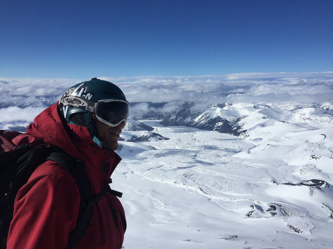 From Volcan Longquimay checking out lines and the awesome amount of snow. Also in this area are the volcans Llaima and Sierra Nevada (although Sierra Nevada is not referred to as a volcan as it is extinct). Access for Sierra Nevada is best from the town of Malalcahuello, it is a long access but the skiing is far more featured than your standard volcano cone. We accessed Sierra Nevada from the Conguello national park side (a beautiful park with old lava flows standing out) and you can also access Llaima from here. Our access was difficult due to the amount of snow that had fallen and we tried many different roads before we found one that was open. Llaima can also be approached from the side of the Los Paraguas ski field and this way is definitely faster and more direct. 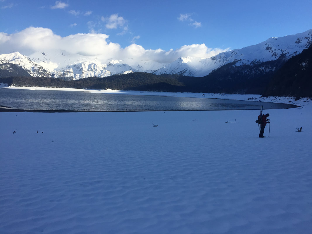 Lago Conquillo in the national park on the way up to Sierra Nevada South again and you have the township of Pucon which is an incredible place to meet other outdoor adventurers, the town is so touristy it almost feels out of place in Chile. Volcan Villarica is the obvious option around here and is extremely popular due to its active crater, you can see the lava on a good day. I would recommend it but be aware that you will be following a highway of other people up, tourists with snowshoes on group tours. There is also Quetrupillan volcan which is similar to Sierra Nevada in that the access is longer, it is not as high but has more features about it. 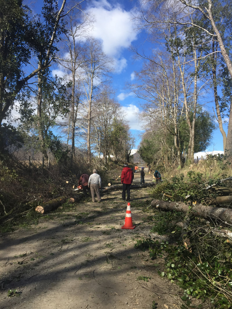 Helping the locals clear the road on the way to Conguillo national park Then you have Lanin. This is a must do. It is the highest in the area at 3725m and for a challenge I would suggest doing it in a day. I thought I had picked a good day to do Lanin with the wind forecast low however as we neared the summit it was raging, definitely the windiest conditions I have experienced. It is a good experience knowing how much wind you can cope with but if this isn't something you are interested in I would suggest picking a day that actually has 0 wind in the forecast. These days are easier to find in September, August seems to be the stormy month and from the middle of September things clear up and the wind typically calms down abit. 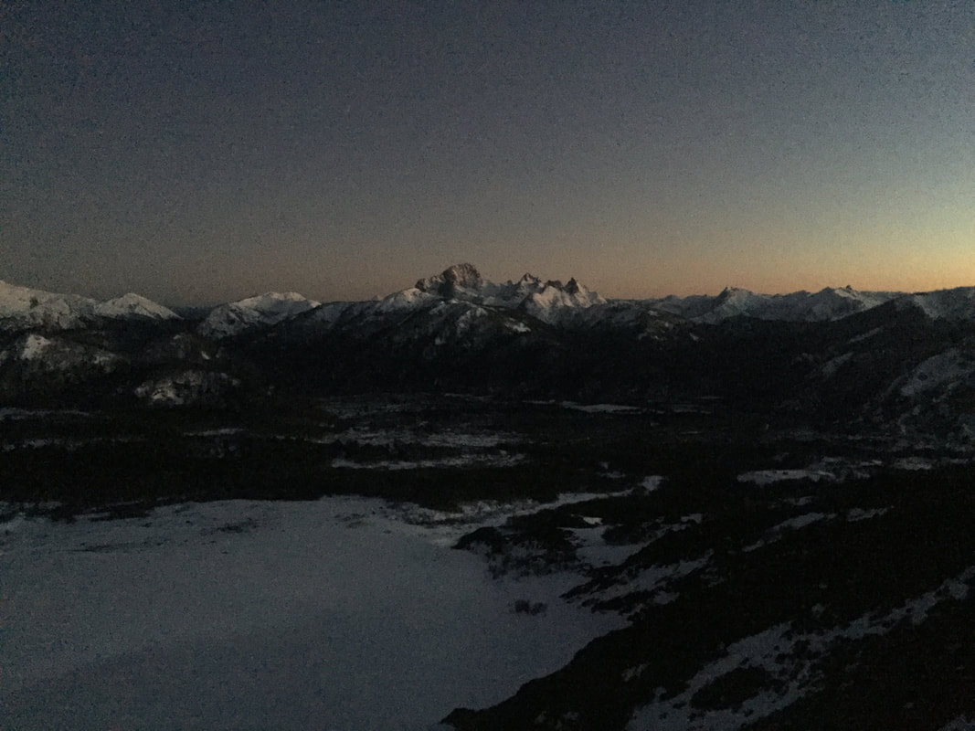 The view as the sun rose on our way up Volcan Lanin We set out at 5 am for Lanin, its a good 10 hour day, and had some spectacular views as the sun rose. There can be a few transitions on the way up from skins to crampons, the standard faff, its a good place to practice skinning on very solid snow at a reasonably steep angle. If you get a warm day you will have a good 2500m of awesome descent. If its colder then its a knee jarring slide for the first 1500m before the snow gets a chance to soften and this second part is fun (trust me). 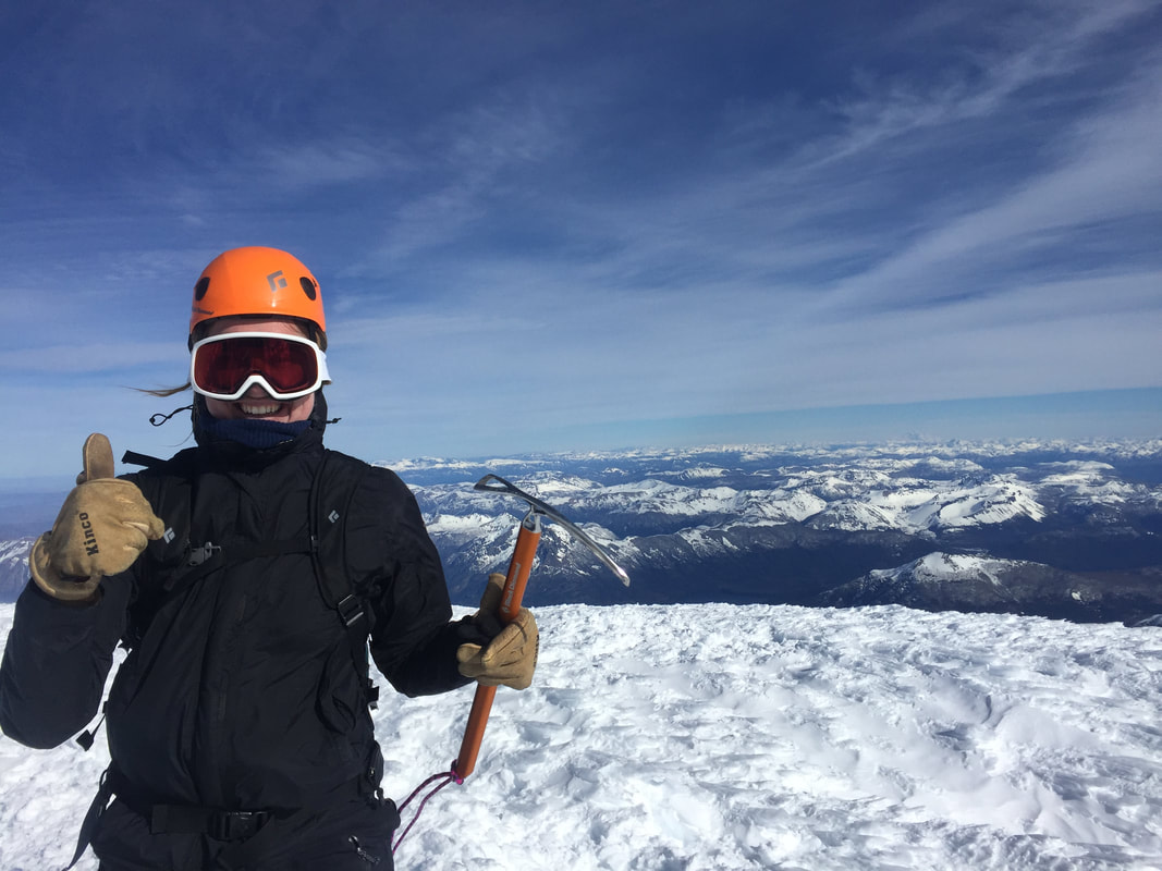 From the top of Volcan Lanin, I'm so stoked I don't even care about my punters gap South of Pucon you have even more volcans, Osorno, Puyehue, Casablanca. The list of volcanos really does go on. They are great but unless you get a good snow season and no wind they are definitely more about the ascent than the ski down so I would suggest picking 4 or 5 and then moving on. 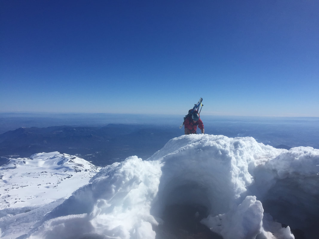 Reaching the summit of Llaima, the special ice formations the result of the wind experienced on these volcans Continuing south of Osorno you really get into Patagonia, we didn't make it south on the Chillean side but I have heard that driving to Coyhaique will be worth your while, here you can probably meet some locals who will be able to tell you more as everyone around here is into their skiing or ice climbing. Following Ruta 7 south of Coyhaique you will start to see mountains to access off the side of the road and Cerro Catillo is supposed to be awesome. Continuing from here into Patagonia you will need to cross into Argentina and then can access the insanity surrounding El Chalten, I will write about this is another episode (:
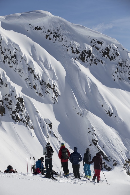
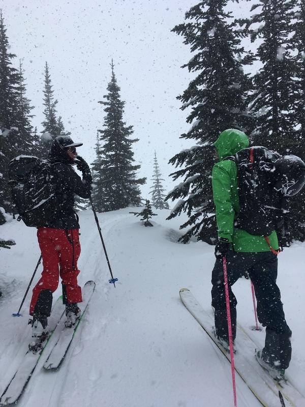
We had high aspirations for our spring ski expedition. We’ve been working long hours most days this winter. Getting 3 of us to have 5 days off in a row together was no easy feat; there was a lot of begging andpleading and possibly some tears shed. Initially our goal this season was to climb and ski Mt Aspiring, a classic 3000m peak in the southwest Southern Alps. Our hard work at work however meant we were unable to properly prepare for this objective (none of us were able to practice any ice climbing) and so we set about making alternative plans. One ground rule was set: Regardless of if we went north or south, east or west, up or down it needed to be a challenge. 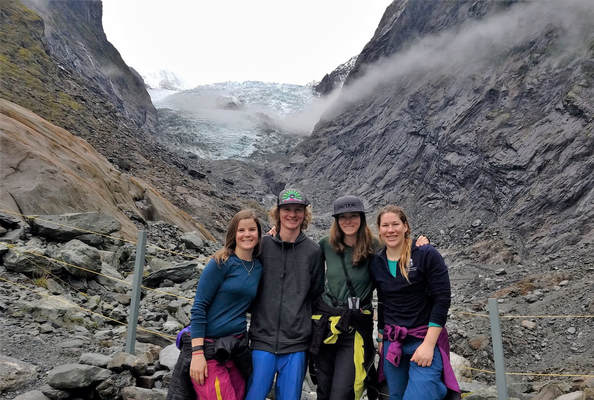 The crew killing time in Franz Josef - Franz Josef terminal face behind us. With the weather looking variable leading up to our 5-day window we left the decision making to the last minute. Sitting in Wanaka, car packed up, rain pounding and winds roaring we decided that the forecast looked slightly more favourable on the west coast so off we went. 1.5 days later in Fox Glacier town we finally got a helicopter ride about ½ way up the glacier to Chancellor Hut. Chancellor hut, the oldest alpine hut in New Zealand still on it’s original site was carried in piece by piece then assembled on site. It has plenty of character and was an awesome hut to wait out the weather in. It also has the best view from a toilet in New Zealand! 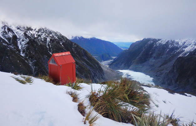 Chancellor Hut Long drop We awoke to a beautiful calm morning after not really sleeping. Gale force winds rumbled through the rafters overnight and made it feel that at any moment the whole hut might blow away. What calmed us down was knowing that the hut had been there since 1931 and surely had seen worse storms. We set off early to hopefully remain in the shade for as long as possible. Heading up from Chancellor hut, we looked for a place where it would be safe to head down the steep mountain walls onto the glacier itself. A slightly tricky down climb with our crampons got us onto the snowy moraine, from where it was smooth sailing to the glacier. 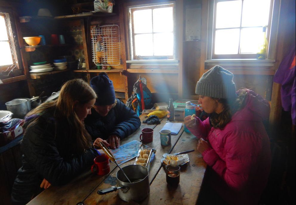 Plotting our ascent in Chancellor hut Plotting our ascent in Chancellor hut We decided we didn’t want to only go uphill on potentially our only fine weather day so we sidetracked to Chancellor dome to bag a mini peak and sneak in a few turns. Here the importance of ski crampons became obvious. The snow was not quite corn; too firm to skin up but too soft to bootpack with regular crampons. Fortunately only one of us didn’t have ski crampons and the delay was minimal but it was a reminder of what useful equipment they are. 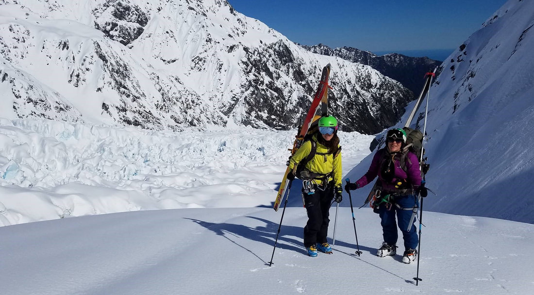 Marian and Gabby heading to Chancellor Dome The view from Chancellor Dome was incredible and well worth the extra effort. There aren't many place in the world where you have jagged peaks and glaciers on one side and ocean on the other. We’re so fortunate to have this amazing area accessible. We roped up for the main traverse across the glacier to Pioneer hut, the route looked safe enough and would typically be this time of year but there were sizable crevasses on either side and this year’s snowpack is lower than average. We arrived just in time for another epic sunset. 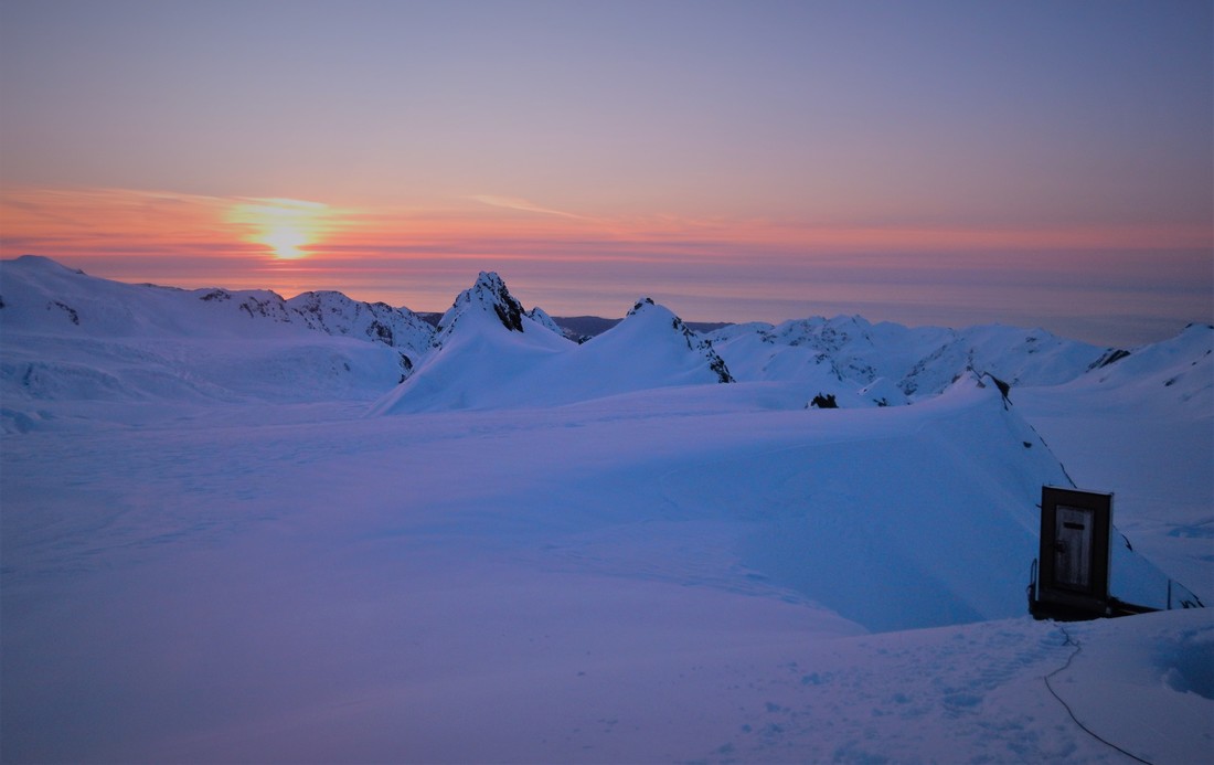 Sunset at Pioneer Hut (and another long drop) Sunset at Pioneer Hut (and another long drop) The weather report at the hut wasn’t sounding positive with another front set to roll in at about 11am. We abandoned plans to ski one of the nearby passes and decided to head straight down to Chancellor and if the weather was still good we’d lap the nearby chutes. We were pretty chuffed with our navigating, finding exactly the right plateau near Chancellor Dome to cut across and therefore avoid any climbing near the moraine. The weather report was spot on and just as we arrived at the chutes above the hut the wind picked up, the clouds rolled in and the snow began to re-freeze. What could have been an epic final ski ended up being very challenging. 50 degrees of sheet ice with exposure below - we were all glad we’d sharpened our edges. 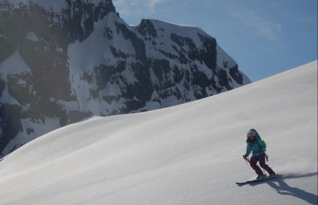 Charlie skiing some corn We were at Chancellor hut once again, listening to the wind and rain, feeling a little disappointed with our relative lack of adventure so far. We’d discussed with another party at Pioneer hut the possibility of walking out along the glacier rather than fly out. “It’s one of the worst walks I’ve ever done” said one, “heaps of really tough bush bashing and then you’ll have to rappel” said another. “Sounds like and adventure” we thought. We set out for a reconnaissance mission that afternoon without packs or skis to see what we were up against. After an hour of down climbing via tree branches and a few sketchy creek crossings we could see the glacier. “It goes” we thought and made plans to head out on foot the next day. 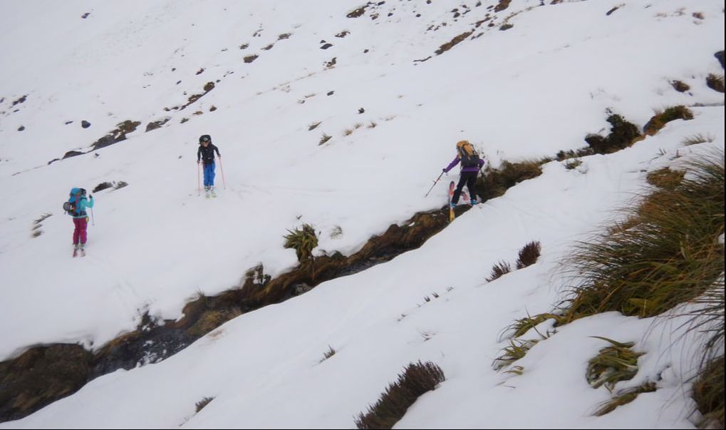 Skiing down from Chancellor Hut, classic NZ touring always involves some creek crossings We skied about 10 turns down from the hut before resorting to bootpacking. The down climb was tricky with heavy packs and skis but overall a fun adventure. The much more challenging part came upon arrival at the glacier. We hadn’t quite made it there the day before and we faced with a difficult choice. Traverse the sketchy scree wall with a 20m drop to the ice, or rope up and go through and under the overhanging ice on the glacier's edge. The group voted for the scree traverse. It was very scary, we couldn’t fall but yet there were no decent holds and skis plus heavy packs meant maintaining balance was very challenging. After 50 very slow meters we eventually found a boulder that looked like it wasn’t going to move too easily and rappelled down to the ice. From there things got a bit easier, one more basic rappel and a whole bunch of boulder scrambling under the overhanging ice until we were able to properly climb onto the glacier. 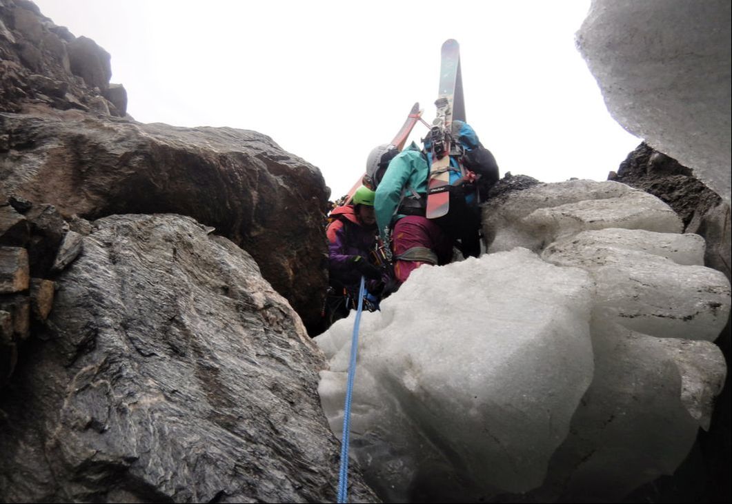 Gabby setting up a rappel for Charlie on the glacier's edge Walking on the glacier made everything so far seem worth it. We were able to ice climb up and over ice walls, walk along bright blue creeks, peer down deep ice holes and experience the breath-taking beauty of the icefall close up. The clock was ticking however and we were running out of day light, we had to make it to the next technical section before nightfall. 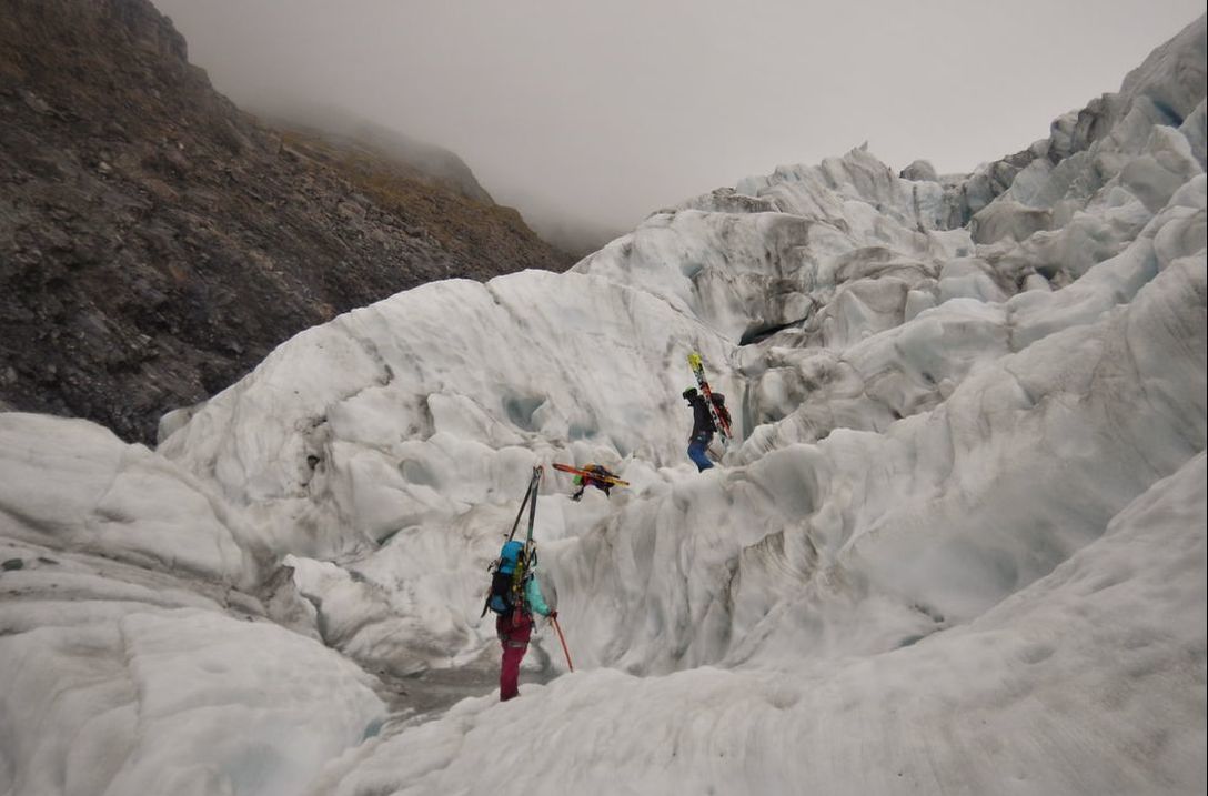 Walking across the glacier - a pretty special place We traversed the glacier to the south side where we had seen from the flight that the descent of the terminal face would be easier. We were hoping for a quick slide down a scree field but ended up in a similar situation to earlier. We traversed too high and once again were forced to set a less than ideal anchor to lower ourselves back down again. We made it to the creek bed right as the sunset and then had to make one more decision. Stay on the south and risk having to cross a very deep and powerful river should we run out of room or cross back north again and risk getting cliffed out having to rely on ropes once more but this time in the dark. 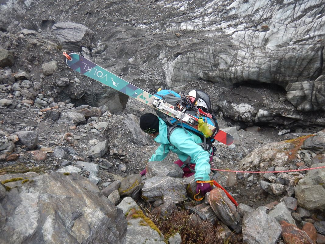 Charlie descending the second sketchy scree and boulder section The group decided the night time river crossing would be more problematic than a descent with ropes so we crossed the glacier once more. By this time it was pitch black and we could only see as far as our headlamps allowed up. This meant for slow moving through the boulders and scree but also barred us from seeing any cliffs below us which probably resulted in a faster overall pace. 2 more hours along the bank and we finally saw the river, with a walking track not too far away from that. 15 hours later we were finally able to remove our ski boots and walk on a smooth surface back to the car park. 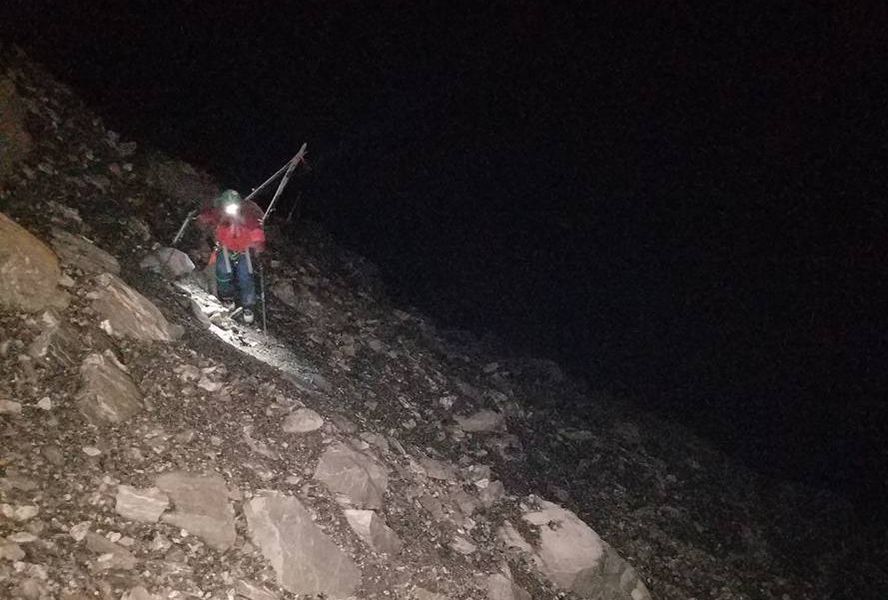 Marian negotiating the final section - about 11pm at night We got what we asked for – a challenge! Maybe not exactly the challenge we were looking for but it was an incredible learning experience. We carried heavy packs with skis and walked with our ski boots on for 15 hours. We had to make unanticipated decisions about route choice and the use of ropes, some of which in hindsight weren’t the greatest. We also had to test our rope and navigational skills under pressure and we're now aware of what we need to work on before Kyrgyzstan. Importantly we learnt about one another's strengths and weaknesses. Gabby is very nervous with exposure but excels with rope work, even under pressure. I’m confident with climbing ice and the use of crampons but much less so on rock. In a pinch I struggled to remember some basic knots. Gabby didn’t eat all day. We have some things to improve but one positive was that we were all amazing when communicating as a group and encouraging one another through the difficult situations.
As a side project so that we can offset the carbon footprint from this small expedition I calculated the carbon footprint of portions of the trip: Driving Wanaka to Franz Josef return - 0.11 metric tons 10-minute helicopter Fox Glacier town to Chancellor hut - 0.127 metric tons Staying in a Hostel in Franz Josef - 0.0036 metric tons As you can see by choosing to walking down from Chancellor hut we significantly lowered our carbon footprint! Staying in a hostel is more efficient than staying in a hotel and we figured staying in an alpine hut with no electricity was negligible. We also ate mostly vegetarian meals and sourced them locally. Refugio Frey is infamous. It is located south and slightly west of Cerro Catedral (ski field) in Bariloche, Argentina. There are numerous trip descriptions, articles etc. written on it and by South American standards this information is very easy to find as a foreigner/ gringo. For some reason because I knew it was so popular and frequented I didn't have high expectations. Yes I had seen the pictures of the rock faces and couloirs but I hadn't expected it to actually be as good as it looked. Wow low expectations pay off. 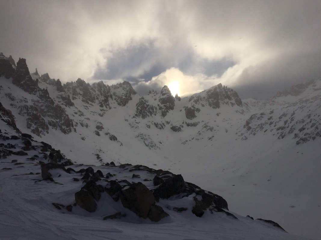 The ridges surrounding Refugio Frey, known as Cerro Catedral Sur The tour in was longer than we had expected, with heavy packs (a tent and cooker in tow, the cooker is completely unnecessary for the record) we set off from the car park at Catedral and after some miscommunication with the staff regarding a one up pass we were those people touring up the ski field. We dropped over the back of the mountain from Puerta Princesa (peak) and our team communication failed us as we, one at a time, skied over a convex roll which released a small slab as I came down last. Small BUT a very good lesson. We vowed to be more careful and take our time to look at line options. Next step, follow the valley down and then climb back up to Frey. Patagonian skin tracks are such hilarious fun. This one crossed a barely there snow bridge over a stream and then squeezed around, through, over and under trees before increasing in steepness making us work for the ridge line. This should have been a good warning for the type of skinning Frey was about to educate us on. 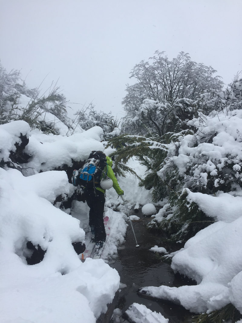 Adventures on Patagonian skin tracks We arrived at the hut and I set up my tent with excitement. Digging out snow and making a wind shelter. We then met the 20+ other ski tourers in the hut and heard about their adventures around the area. The consensus was Frey was skiing incredibly at the moment and the avalanche danger was very minimal. The basin that Frey is located in is lucky as it has very steep rock faces on all sides which means that in any conditions at least one aspect will be skiing well. The forecast for the next day was primo so we got some ideas on routes and planned to wake up early. "Three in the tent and the little one said roll over". There was zero rolling over to be done because that would have meant squishing another person. We were warm though and when the standard Patagonian wind started to howl at 4 am we were still comfortable. Morning dawned and we were out. Chucky suggested the first run up what looked like a pretty steep committing face and I was nervous but keen. It was indeed committing and a definite step up from the previous day. Keep a calm head when your downhill ski slips out from underneath you while skinning, it will be fine. The view and the ski down were worth it and we chugged on to our next route which was a nice laid back tour up and fun ski down with some features to provide short moments in the air. 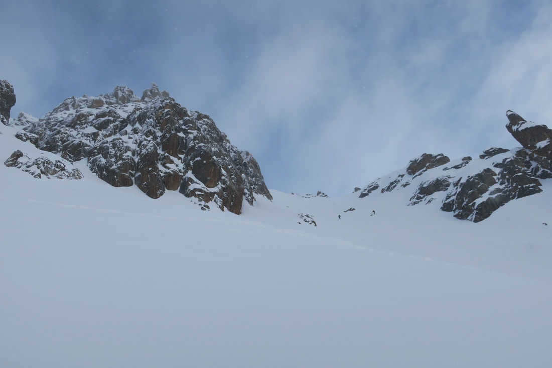 The committing skin track (it felt more impressive in real life). PHOTO Hannah James Chucky was hungry for more and Hannah and I were literally hungry so the two of us headed back to the Frey to make some lunch and decide on our next move. It was 3 pm and we were just thinking we could try something technical but short when a few of our friends from the night before came in to say they had just skied the best snow of their lives and it would be a sin if we didn’t go out and do the same route. We hustled. The track up looked hard and it was predicted to take 3 hours, it is dark by 7 pm so we had time. If ever there was a time to use the word beautiful to describe a skin track this was it. The previous riders had done a superb job of carving it up a reasonably steep access. I was appreciative. The wind picked up, the clouds started rolling in. We made a video dairy claiming to have our "adventure pants" on and continued on. We were rewarded within 1.5 hrs (hallelujah we are not as slow as we thought) by the view of the lake and the 'Principal peak' of Catedral. The ski down was indeed as incredible as the claims. Effortless, light, pillowy, face shots, do I need to continue?? Whooping with delight we boosted through our last transition back up to the ridge then skins off and down to Frey. 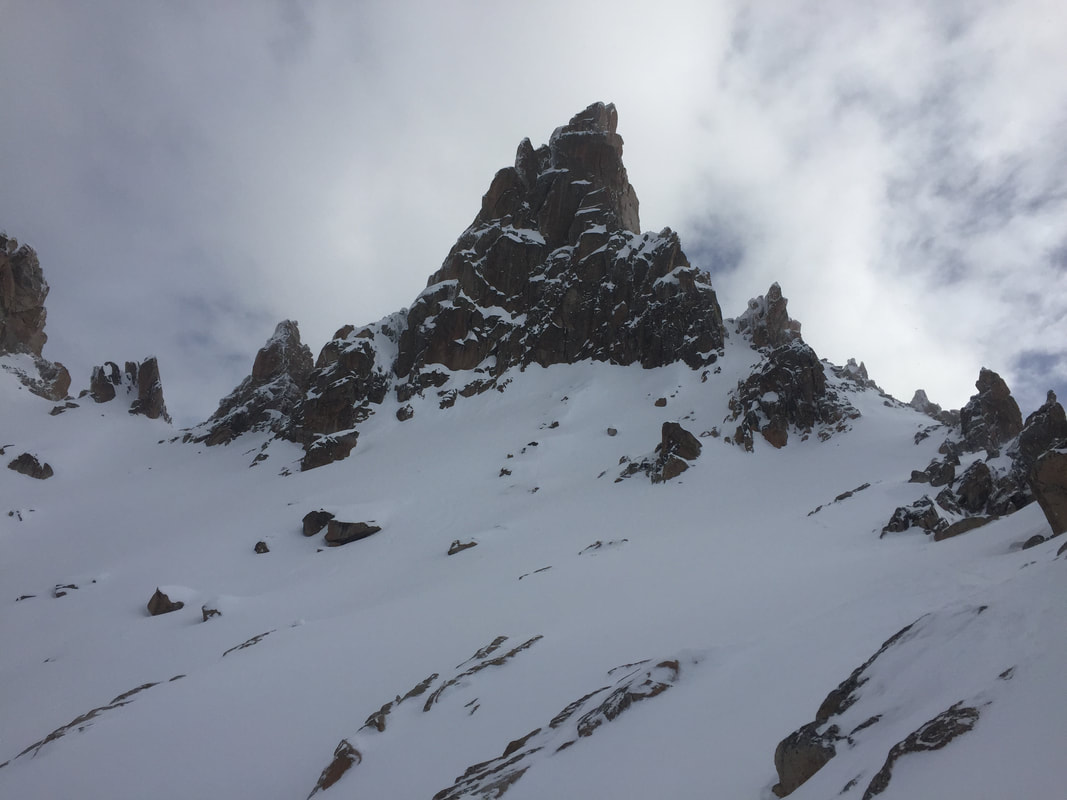 Our destination, Cerro Principal! The start of the best powder! The hut had cleared out with the incoming terrible weather and we were spending the night inside in the interest of not getting blown off the mountain. That night we had a spanish lesson with the hut wardens; the most important word is cosas (things) followed by pointing and smiling. The relentless wind. The wind. Oh the wind. We may have been inside but I still didn’t sleep. The next day we were leaving via the valley and then traversing around the mountain to Catedral. It turned out to be harder than we thought. A lot of new snow meant the track was hard to follow and then when we were clearly on it the snow became very wet and heavy and the standard Patagonian adventure skinning started again. Over rocks, through streams, between bushes 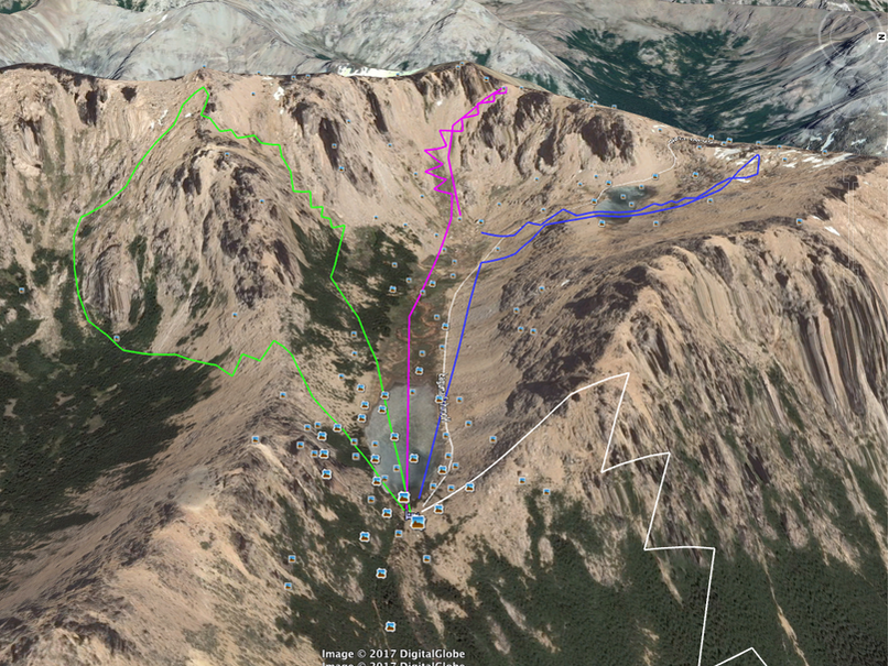 Our routes: White (access track), Purple (first route, committing skin track), Blue (second route, mellow), Green (third route, via Cerro Principal). About then, still 3 hours from the end of the track, I learnt my biggest lesson of the trip. Bring more food. I had run out of food and was not in my happiest of places. It turns out I am useless at life when hungry. Skis on, skis off to cross a stream/clamber down a rock, skis back on again.. Repeat. The track probably wasn't as bad as I'm making out. We got to the end at 4 pm, I had last eaten at 9 am. To put it in perspective Chucky asked me if I wanted to go back in the day after because the weather was looking good again and there would be fresh snow and I promptly declined, despite absolutely loving the place and the snow and the ski lines, because the memory of that track was still too painful. All in all an incredible experience with more valuable lessons learnt: primarily take more food, always communicate and take your time in unknown terrain, have confidence in your abilities and don't underestimate Patagonian skin tracks. 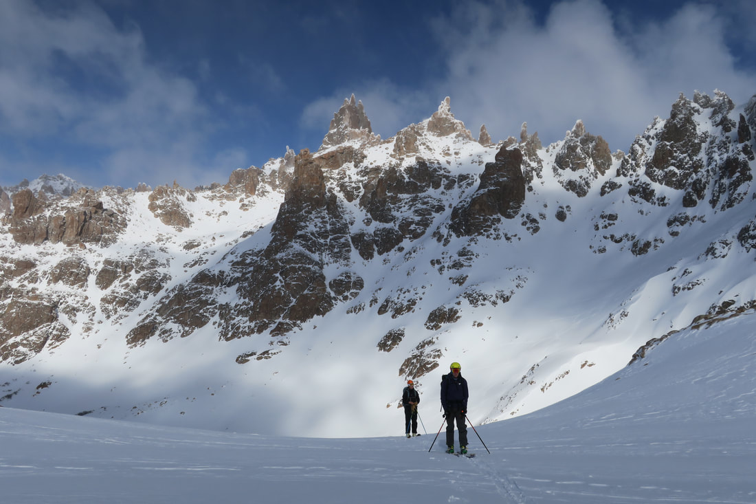 Refugio Frey with Cerro Principal in the background, Patagonia is breath taking. PHOTO: Hannah James
I grew up one hour East of Vancouver in a valley surrounded by mountains. On clear sunny days we had spectacular views of Mt Baker, the second most heavily glaciated volcano in the Cascade Range and the third highest peak in Washington State. Mt Baker holds the world record for most amount of snowfall in a year (29 meters) and Mt Baker ski area remains one of my favourite places to ski in the world. It is no surprise that when I started backcountry skiing and ski mountaineering, summiting Mt Baker was at the top of my list. 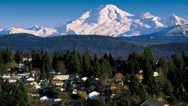 In May, after our attempt at Rainier, Marian and I had the perfect weather window to attempt to climb Mt Baker with a ski from the summit. We had 2 clear sunny days and a deep enough snow pack for many of the snow bridges, which cover the crevasses, to still be in tact. After a long descent off Rainier the previous day, we arrived back in Vancouver with just enough time to unpack and repack for an early departure to the Schreiber’s Meadows trail head. We chose to climb up the South facing Easton Glacier. We made it to base camp with plenty of time to get settled in, eat dinner, and watch the sun set. 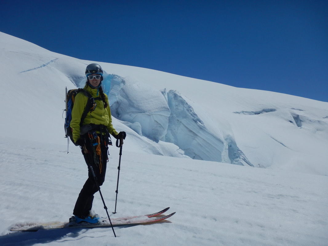 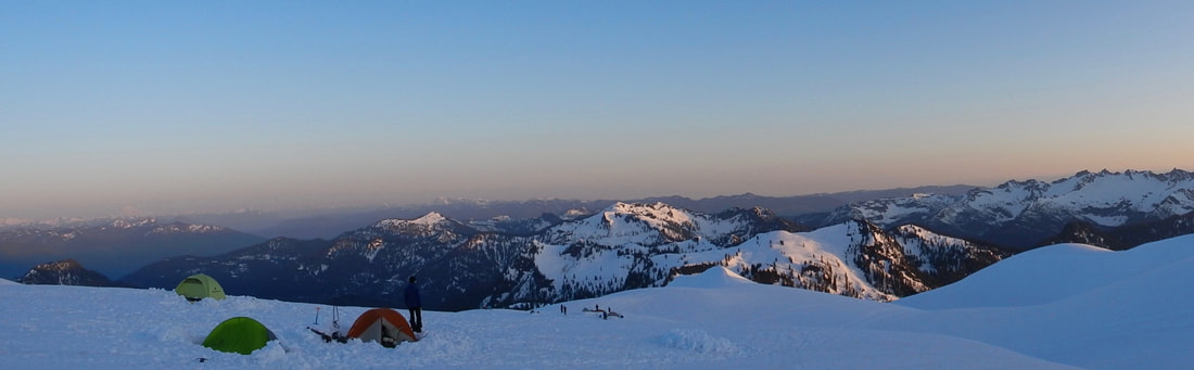 We started up the glacier at 5 am and were on the summit at 3285m by 10 am, just as the face of the Roman Wall started to soften. Perfect spring corn on the way down was the cherry on the cake. As we carefully picked our line to avoid crevasses and softening snow bridges, we commented on how lucky we were that the higher than usual snow pack allowed us to ski all the way back to the car. 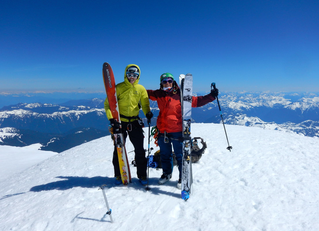 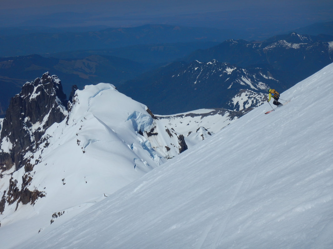 The higher than usual snow pack and late closing of many of the mountains on the West Coast made me confident that skiing would continue well into the summer months. It was a shock when I read an article a few days later that said the Camp of Champions on Blackcomb Glacier in Whistler would not be opening for the first time in almost 30 years. Though I have never attended the Camp, it is a staple in the Whistler community (a place I have lived and spent a lot of time). A well-written letter from the director explained that though there was more snow than in previous years, the snowpack had too much air in it to (not enough soft wet snow) build the jumps required for the camps. On my most recent trip to Whistler in January, they has snow machines blasting on the glacier in an effort to preserve it, something that continued for the remainder of the season.  The Blackcomb Glacier is currently 35 feet lower than it was in 1989 when the camps opened. Glaciers in the North Cascade Mountains have shrunk by 50% since 1900 and will continue to do so unless major changes are made. It is hard to imagine not being able to ski in the mountains I grew up in, not to mention the detrimental effects receding glaciers will have and are having on our current way of life.
It hadn't snowed since the dumping we had in April and despite various land owners in the area telling me there was "bugger all snow up there" I remained optimistic. I hadn't put my skis on in over a year after my knee surgery and I was rearing for an adventure. The other team members, all snow crazy individuals, were extremely excited about walking long distances to get minimal turns in. The goal was to reach the ridge glacier on the SW ridge below Mt Hutton for some guaranteed snow, views and glacier travel practice. 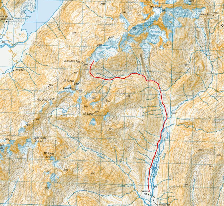 Route up to the Ridge Glacier from Memorial hut We encountered our first speed bump on our first night after a mid night arrival into Tekapo when we realised just how low the temperatures were expected to get during the weekend, -11C. Given previous chilly tenting experiences we doubted that our gear, or our fortitude, would be up for the challenge. When we arrived at Memorial hut the call was made to do a day trip up the Alisa Stream to see the snow coverage and then go for the Ridge glacier as a day trip the following day and stay in the hut that night as we were expecting a front through. 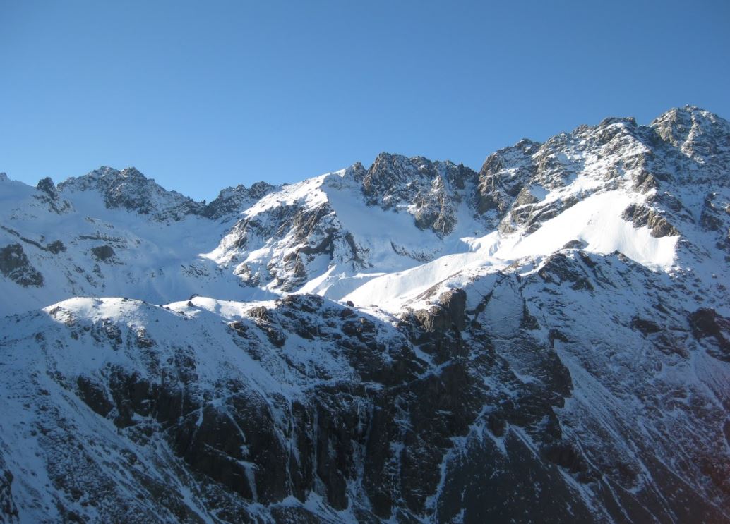 Mt Lucia on the opposite side of the valley with all its snow, in the shade. Our side of the valley, in the sun was a stark comparison! PHOTO: Julian White It was an incredible day and we were eventually rewarded by snow but the land owners description had been accurate, on the sunny aspects there was bugger all. Yet we had skied and I had not forgotten how to ski, we were stoking! The next morning, after a night of sleep talking/ yelling at each other in the hut we woke to snow! The excitement soon fizzled though as we attempted to navigate the valley floor now covered in an inconvenient depth of snow. The formula of 1 hour for 5 km and 1 hour for 500 m vertical was not working and we decided we should have left the hut well prior to first light. My spirits were down as I realised that we would not be able to make the Ridge glacier at this speed and I lost motivation to keep going at the prospect of skiing disguised rocks. The team, to their credit, did not falter and remained pumped to ski what appeared to me to be a strip of ice and rocks covered in icing sugar on the approach to the Faraday glacier. Their enthusiasm was infectious and we continued on. Lynette and Sam missioned it further up the slope and skillfully linked a decent amount of turns while Julian and I watched insisting there was only enough coverage for two people. Julian, having just completed and impressive 12 months of skiing, shared some words of wisdom while we waited. Of all his ski trips and sagas he had realised that is often takes a second trip or second attempt to reach your initial goal, so many lessons are learnt the first time! 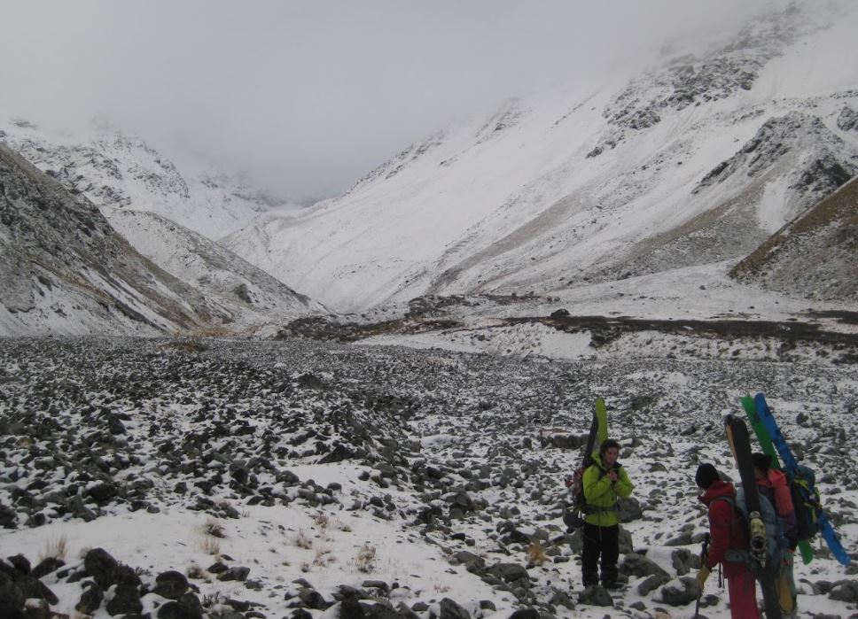 Decision making time, up to the left is access to Ridge glacier and straight up the valley in the cloud is the Faraday glacier. Lynette and Sam ended up skiing up the valley on the right. PHOTO: Julian White Back in the hut again that night we debriefed over sharns and decided that the Ridge glacier was definitely doable in a day trip from Memorial hut if you left earlier in the morning, if the conditions were more productive or if you drove further up on the true left of the stream. Or if you grew some balls and camped further up the valley.. All good lessons and good experiences! At some point during the evening someone... Lynette... Asked, "we are skiing tomorrow again right?" We all looked at each other and said "yes, yes that sounds good" internally I was thinking "oh shit, I'm going to die". The next morning we made good time up to Lady Emily hut and then further up the right hand side to the standard winter touring routes where we found some great lines to ski. Extremely questionable snow pack greeted us on our accent and we heard "whoompfing" as we climbed and a snow pit showed slab coming away immediately due to an old granular layer. Our area was safe due to the large number of big rocks showing and acting as anchors but further up there were no rocks visible and we decided not to go any further. 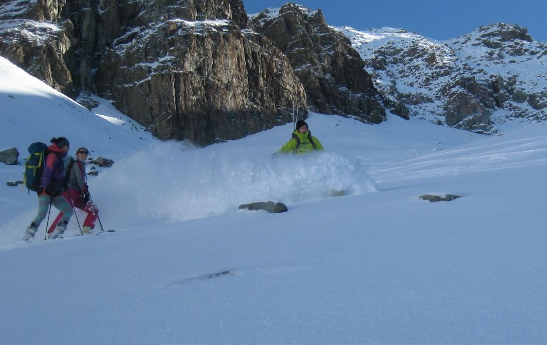 Our descent, Sam carving some sweet turns on his new splitboard with plenty of rock anchors around and beautiful dry snow on top of ice. PHOTO: Julian White All in all another great experience with awesome people in an amazing location! Many lessons learnt, some disappointments but at the end of the day it wouldn't be an adventure if it all went according to plan and isn't that why we do these things, to have an adventure!? 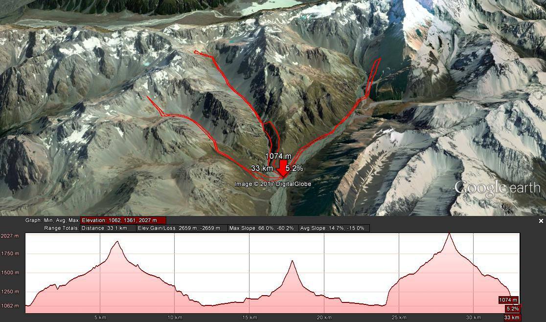 Trip profile over the 3 days with a very slow travel day in the middle! Journey map thanks to Julian White
Mt Rainier is one the highest mountains in the United states and definitely one of the most prominent at 4394m (14,417ft) with 4026m of prominence. It dominates the skyline in the Pacific North West, standing out from the surrounding peaks just asking to be climbed. It was after seeing stunning views of it from Crystal mountain a few years ago that I decided I really wanted to ski it. Back then I didn’t have the skills or knowledge and I was at university so I also didn’t have the time. Now though I have the skills, knowledge and time so in January Gabby and I put it on our spring time bucket list.  Marian at Crystal Mountain last year, Mt Rainier in the background There are several main routes up Mt Rainier. The most common is the well tracked Disappointment-Cleever route, it’s the least technical but also the most popular (could be considered crowded later in the season). It’s also not as ideal for skiing so we decided to do the Emmons-Winthrope Route on the more western side. It’s longer and more glaciated but the more common route for skiing. Our other friend Ben who joined us for the trip had previously climbed this route was confident it was the route for us. 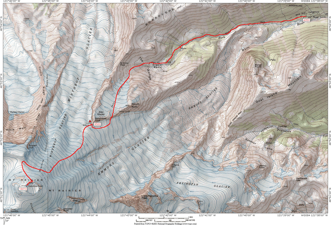 Our approximate route to to Steamship Prow and then along the Emmons-Winthrop Glaciers We definitely thought we had the skills and knowledge but at the same time we were unprepared and didn’t seriously consider the altitude. We’re both relatively fit and strong but I had spent the previous month surfing and doing volunteer work in the Caribbean. Gabby had been working in Hong Kong mostly kayak guiding. We underestimated the difficulty of climbing/skinning up 4000 vertical metres after basically sitting at sea level. It was one of a few mistakes in our planning. We had heavy packs with luxuries such as slippers and snacks for days. We’ve done overnight ski touring trips before but all our previous glacier trips involved being helicoptered to a hut. Physically carrying the gear for glacier travel and for overnight camping also added a huge weight to our pack. It was really hard and after only about 1000 vertical meters we were crawling along, looking for places to ditch stuff from our packs. 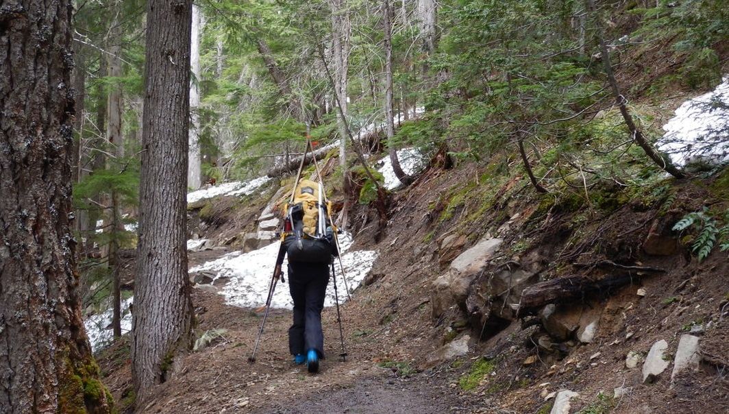 Gabby walking along the summer hiking trail to begin We planned to ascend and descend in two days with the night spent at Camp Schurman (2800m), at the base of the Emmons Glacier. The last few hundred meters to the camp were even slower, we were moving at about 200 vertical metres per hour and just made it to camp in time to set the tent up in the last few minutes of daylight. We were exhausted and were beginning to feel the altitude but we decided it wasn’t too bad and we should attempt to summit the next day. 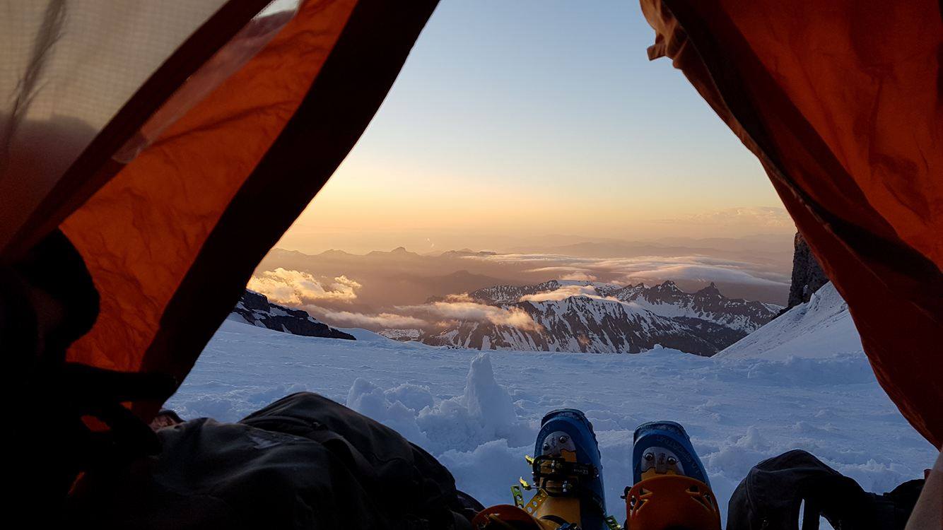 Sunset view from the tent at Camp Schurman We set off roped up at 5am, feeling good with much lighter packs. We negotiated our way around smaller crevasses with ski crampons on the firm early morning snow for about 2 hours before the altitude again started to take it’s toll. After a rest at about 3500m all three of us weren’t feeling too good and Gabby’s resting heart rate was still very high. At that point we thought it would be unsafe to continue further and we turned around. 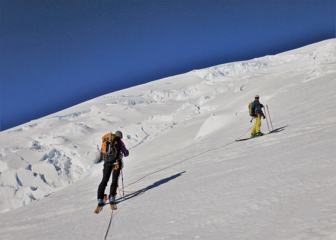 Gabby and Ben ascending the glacier early in the morning We were all disappointed but the descent down the glacier past steamboat prow in the mid-morning corn was perfect and made us feel significantly better about our decision. We made GS turns in hero snow, hooting the whole way down Glacier Basin. We had a great few days and learnt a lot. The biggest take home lesson for Kyrgyzstan was the need to be more physically prepared. Training with heavy packs will be essential, as will having light weight gear. I can see many thousand weighted step-ups in the next few months. Having a base camp at a medium altitude will be necessary too to minimize the effects of altitude and some mental preparation for the long days will also be required. Our mental fitness is going to be just as important as our physical fitness. 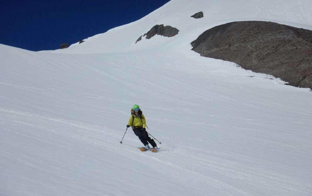 Gabby skiing down enjoying the perfect spring corn. We entered the Whiteroom last week up at Whitecap Alpine Adventures. 6 winners were chosen by Arc'teryx in a Social Media contest to go up to Whitecap for 4 days, all included. I was lucky enough to join and we were all winners when talking about the snow conditions for April. Avy conditions were fairly stable and visibility was amazing. A very different experience than the last time I was up there.
|
AuthorMarian Krogh Archives
August 2019
Categories |
 RSS Feed
